A Landscape Built for Walking
The Finger Lakes region is, at its core, a landscape of elevation change. The lakes sit at roughly 400 to 700 feet above sea level, while the surrounding hills and ridges rise to 2,000 feet and more. The streams that connect high ground to lake level have carved hundreds of gorges, ravines, and glens, and trails follow many of them. Add in an extensive state park system, a 950-mile regional trail network, and the only national forest in New York State, and the Finger Lakes has hiking to fill years of weekends.
What follows is a selection of the best hikes in the region, organized by difficulty. Trail conditions change seasonally — gorge trails close in winter, creek crossings swell after rain, and mud season (late March through April) makes some backcountry trails messy. Always check current trail status before heading out.
Strenuous Hikes
Gorge Trail, Watkins Glen State Park
The most popular hike in the Finger Lakes is also one of the most physically demanding — not because of distance (it is only 1.5 miles one way) but because of the 800 stone steps that climb through the gorge, gaining about 500 feet of elevation. The trail passes behind waterfalls, through narrow rock corridors, and over stone bridges. The footing is often wet. Plan 45 minutes to an hour for the ascent, longer if you stop for photographs (and you will). To avoid crowds, start before 9:00 AM or after 4:00 PM. The Rim Trail offers a less dramatic but crowd-free return route along the top of the gorge.
- Distance: 1.5 miles (one way); 3 miles round trip via Rim Trail return
- Elevation gain: ~500 feet
- Season: Mid-May through early November
- Dogs: Not allowed on Gorge Trail; allowed on Rim Trail
Gorge Trail to Lucifer Falls, Robert H. Treman State Park
The trail to Lucifer Falls follows Enfield Creek through a steep-sided gorge south of Ithaca. The path climbs via stone steps and wooden bridges, and the canopy of old-growth hemlock keeps the trail cool even on hot days. Lucifer Falls itself is a 115-foot cascade that fans over a series of shale ledges — the viewing platform provides a direct view of the full drop. The return via the Rim Trail adds variety. This hike is less crowded than Watkins Glen and feels more wild.
- Distance: 3.6 miles (loop via Rim Trail)
- Elevation gain: ~400 feet
- Season: Mid-May through November
- Dogs: Allowed on leash
Grimes Glen
Grimes Glen, near Naples in Ontario County, is a wild gorge hike that requires wading through ankle- to knee-deep water for much of its length. There is no maintained trail — you walk up the streambed, negotiating slippery rocks, until you reach two waterfalls: the first about 60 feet, the second about 50 feet. The glen walls are shale and sandstone, and fossils are visible in exposed layers (collecting is prohibited). This is an adventure hike, not a stroll. Wear water shoes or old sneakers that you don’t mind getting soaked. Do not attempt after heavy rain, when water levels rise rapidly and dangerously. No facilities at the trailhead.
- Distance: ~1.5 miles round trip
- Elevation gain: Minimal (wading, not climbing)
- Season: June through September (water too cold and high in spring)
- Dogs: Technically allowed but the terrain is challenging for dogs
Conklin Gully and Parish Glen
South of Naples in the Bristol Hills, Conklin Gully (also called Hi Tor State Forest Access) and nearby Parish Glen offer rugged, unmaintained gorge hikes for experienced hikers. Conklin Gully requires scrambling over rocks and wading through shallow water to reach a series of smaller waterfalls. Parish Glen is similar in character. These are not marked trails — they are creek walks through wild ravines. Bring a map, tell someone where you are going, and be prepared to turn back if conditions deteriorate. No signage, no facilities, no cell service in the ravines.
- Distance: Variable (1-3 miles round trip depending on turnaround point)
- Season: June through October
- Dogs: Not recommended due to scrambling terrain
Moderate Hikes
North and South Rim Trails, Taughannock Falls State Park
These parallel trails run along the rim of the Taughannock gorge on either side, offering dramatic top-down views of the 215-foot falls and the gorge below. The South Rim Trail includes a dedicated overlook platform with the best aerial perspective of the falls. Each rim trail is about 1.5 miles one way. Combine both rim trails with the flat Gorge Trail at the bottom for a roughly 5-mile loop with moderate elevation change. The gorge views are particularly dramatic in winter, when ice formations cling to the shale walls.
- Distance: 3 miles (both rims) or 5 miles (full loop with gorge trail)
- Elevation gain: ~300 feet
- Season: Year-round (rim trails remain open when gorge trail closes seasonally)
- Dogs: Allowed on leash
Finger Lakes National Forest
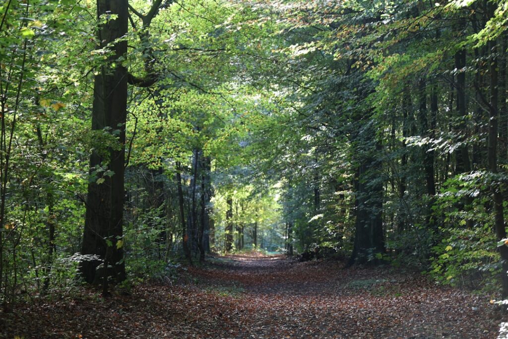
The Finger Lakes National Forest occupies a 16,212-acre ridge between Seneca and Cayuga Lakes in Schuyler County — the only national forest in New York State. The landscape is open meadows, rolling hills, and deciduous forest, crisscrossed by roughly 30 miles of interconnected trails. The Interloken Trail (12 miles, point to point) is the backbone, running north-south through the forest. The Gorge Trail Loop (3.5 miles) follows a stream through a small ravine. The Backbone Trail (5.5 miles) traverses the ridge with views of both lakes on clear days. Free primitive camping is allowed throughout the forest — pick any flat spot at least 100 feet from water and trails.
- Distance: Variable (3.5 to 12 miles depending on trail choice)
- Elevation gain: Gentle to moderate
- Season: Year-round; trails are open for hiking, cross-country skiing, and snowshoeing
- Dogs: Allowed on leash or under voice control
Bristol Hills Trail
The Bristol Hills Trail is a 56-mile section of the Finger Lakes Trail system, running from Ontario County Park near Naples north to the Finger Lakes Trail’s main east-west corridor. The trail traverses the hilly terrain south and west of Canandaigua Lake through mixed hardwood forest, crossing streams and passing through state forest land. Most hikers tackle day-hike sections rather than through-hiking the full distance. The southern sections near Naples offer the best views and pass through Hi Tor State Forest.
- Distance: 56 miles (full trail); 4-8 mile day sections available
- Season: Year-round (some sections may be wet or overgrown in spring)
- Dogs: Allowed on leash in state forests
Easy Hikes and Walks
Gorge Trail, Taughannock Falls State Park
The flat, three-quarter-mile walk from the parking area to the base of Taughannock Falls is the best low-effort waterfall hike in the Finger Lakes. The trail follows the creek bed through a gradually narrowing gorge until the falls come into view — a 215-foot single drop framed by 400-foot shale walls. The surface is gravel and mostly level. Strollers can handle it, though the last stretch gets rockier. This is an ideal hike for families with young children or anyone with limited mobility.
- Distance: 1.5 miles round trip
- Elevation gain: Negligible
- Season: Year-round
- Dogs: Allowed on leash
Keuka Outlet Trail
The Keuka Outlet Trail follows a historic canal towpath and railway bed for 7 miles from Penn Yan to Dresden, tracing the outlet stream that connects Keuka Lake to Seneca Lake. The trail is flat, wide, and shaded — an easy walk, run, or bike ride. Along the way, you pass ruins of old mills and factories that once powered small industries with waterpower from the outlet’s 270-foot drop. Interpretive signs explain the history. Both endpoints have parking. The trail is equally good in either direction; the Penn Yan end starts near downtown, where you can grab coffee at Amity Coffee before heading out.
- Distance: 7 miles one way; 14 miles round trip
- Elevation gain: 270 feet (gentle grade over 7 miles)
- Season: Year-round
- Dogs: Allowed on leash
The Finger Lakes Trail System
The Finger Lakes Trail (FLT) is a 950-plus-mile network of marked trails that crosses the southern tier of New York State from the Catskills to Allegany State Park. The main east-west trail passes through the Finger Lakes region, and a series of branch trails extend north along the ridges between the lakes. The FLT is maintained by volunteers of the Finger Lakes Trail Conference, and trail conditions vary — some sections are well-groomed, others are rugged and overgrown. Lean-tos and primitive campsites are available along the route for backpackers. Maps are available from the Finger Lakes Trail Conference website.
Trail Safety and Etiquette
- Gorge safety: Stay on marked trails. Every year, injuries and fatalities occur when people climb off-trail on gorge walls or enter closed areas. The rock is fractured shale that crumbles under weight.
- Water crossings: Creek-walk hikes (Grimes Glen, Conklin Gully) should never be attempted after heavy rain. Flash flooding in narrow gorges is genuinely dangerous.
- Cell service: Coverage is spotty to nonexistent in many gorges and forested areas. Download trail maps before you go. Carry a paper map for backcountry hikes.
- Hunting season: Deer hunting season (late October through December) is active in state forests and the Finger Lakes National Forest. Wear blaze orange if hiking during this period.
- Leave no trace: Pack out all trash. Do not stack rocks (cairn building damages the streambed ecosystem). Stay on trail to prevent erosion.